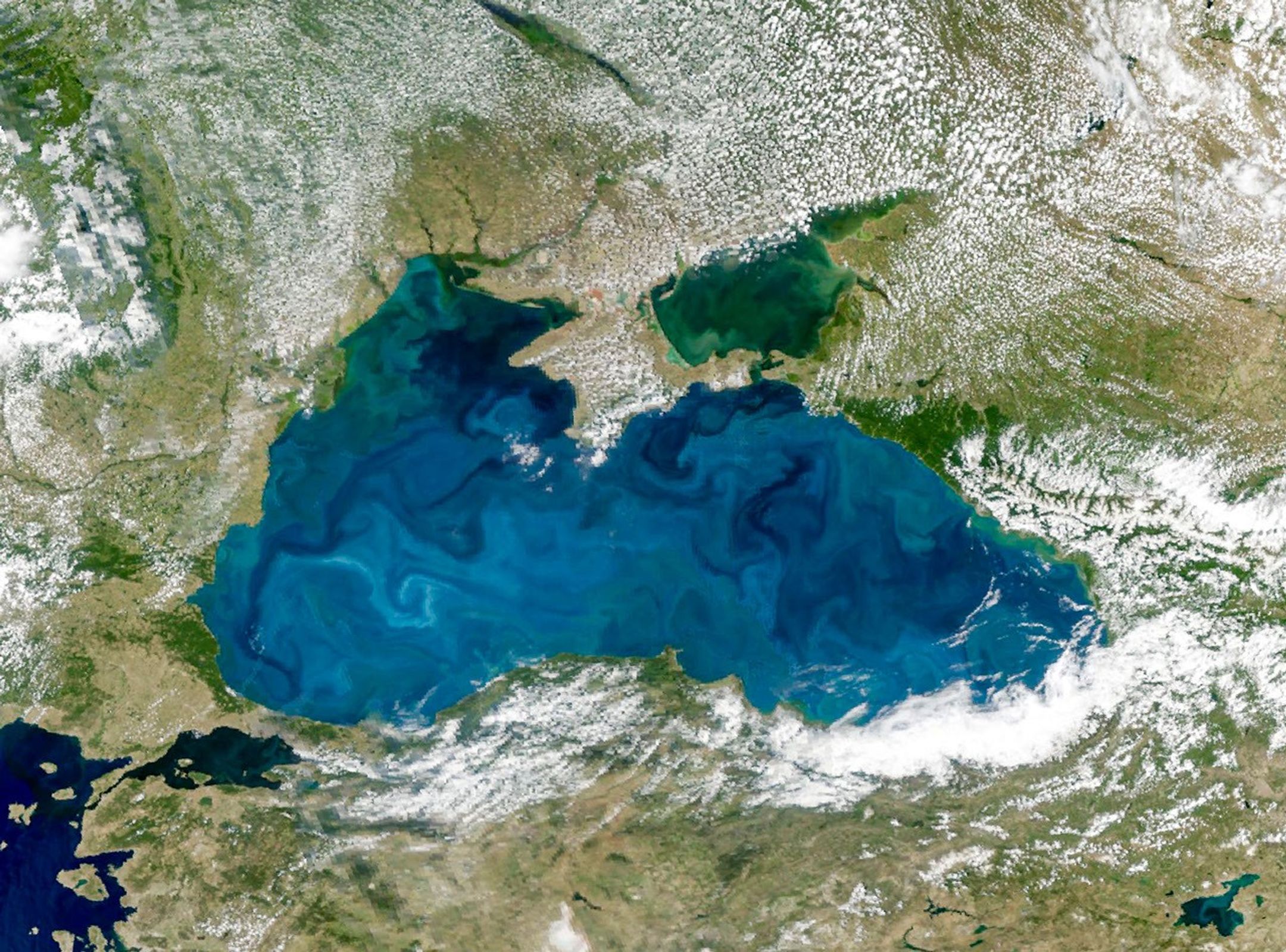
A Turquoise Tint for the Black Sea
The Black Sea sits at the boundary between Europe and Asia and connects to the Mediterranean Sea via a chain of waterways. Its surface often appears dark, but each spring and summer it transforms into a striking expanse of swirling turquoise. The OCI (Ocean Color Instrument) on NASA’s PACE (Plankton, Aerosol, Cloud, ocean Ecosystem) satellite captured this image (above) of the colorful waters on June 22, 2026.
The turquoise color is likely caused by coccolithophores, a type of phytoplankton covered with calcium carbonate plates that can give surface waters a milky-blue appearance. These types of phytoplankton tend to dominate in late spring and early summer. Other times of the year, diatoms—a type of microscopic algae with silica shells—can become more prevalent, and they tend to darken the water rather than brighten it.
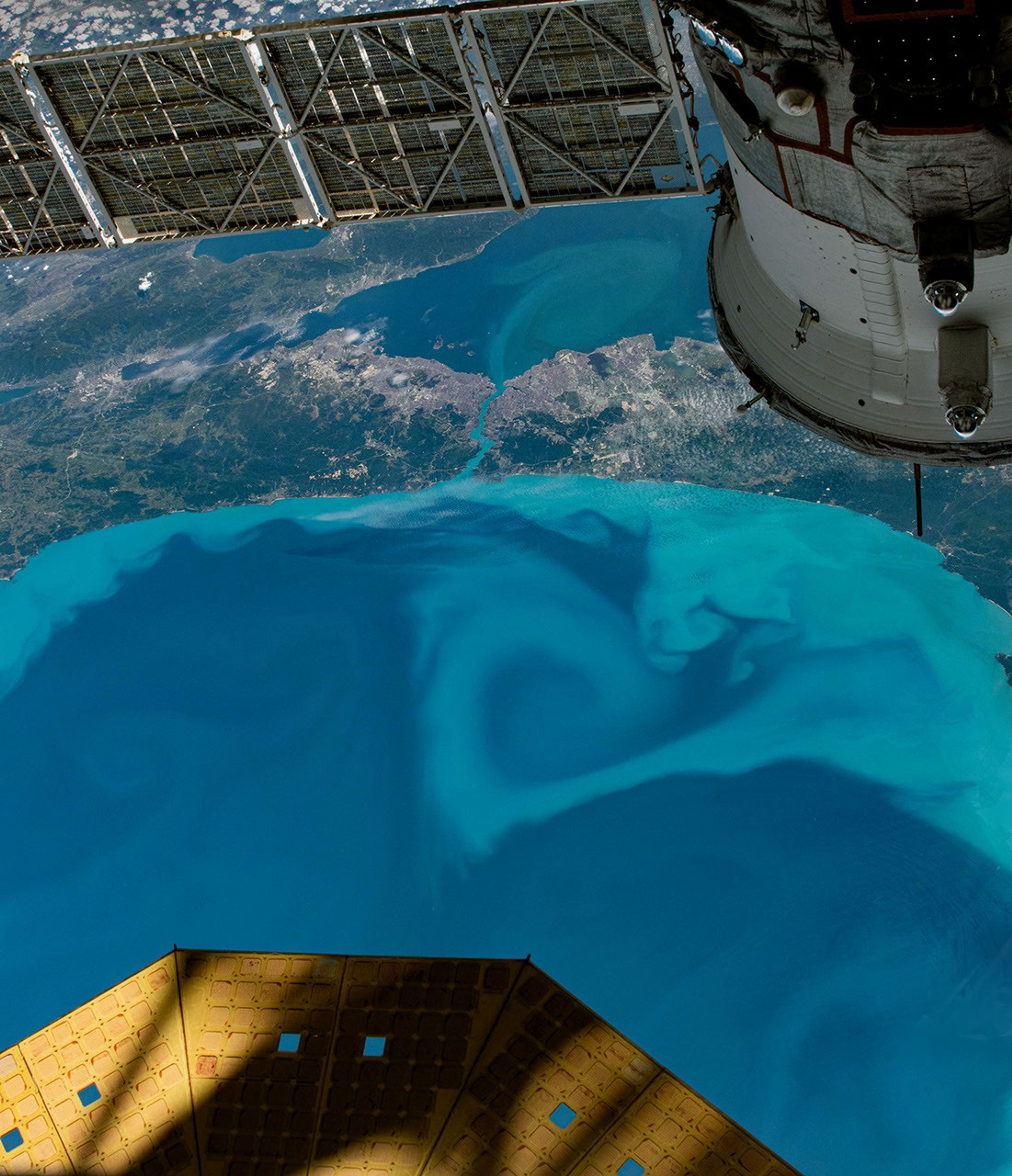
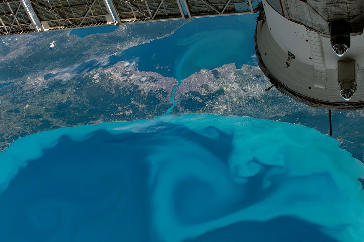
The Bosphorus, the narrow strait running through Istanbul that connects the Black Sea with the Sea of Marmara, also turned turquoise. An astronaut aboard the International Space Station photographed the strait on May 27, 2026 (below), about a month before the PACE image, capturing blooming phytoplankton as it traced currents on both sides of the waterway. (Note that north is oriented toward the bottom of the frame.)
Though coccolithophores are microscopic, they become so abundant during a bloom that they become visible from space. This makes remote sensing a useful tool for researchers studying bloom dynamics in regions where direct sampling is limited. Beyond their visibility, these blooms also contribute to the ocean’s carbon cycle. When they die, some of the carbon they’ve taken up sinks to the seafloor, where it can remain stored for long periods of time.
NASA Earth Observatory image by Michala Garrison, using PACE data from NASA EOSDIS LANCE and GIBS/Worldview and the NASA Ocean Biology Distributed Active Archive Center OB.DAAC. Astronaut photograph ISS074-E-619520 was acquired on May 27, 2026, with a Nikon Z9 digital camera using a focal length of 50 millimeters. It is provided by the ISS Crew Earth Observations Facility and the Earth Science and Remote Sensing Unit at NASA Johnson Space Center. The image was taken by a member of the Expedition 74 crew. The image has been cropped and enhanced to improve contrast, and lens artifacts have been removed. The International Space Station Program supports the laboratory as part of the ISS National Lab to help astronauts take pictures of Earth that will be of the greatest value to scientists and the public, and to make those images freely available on the Internet. Additional images taken by astronauts and cosmonauts can be viewed at the NASA/JSC Gateway to Astronaut Photography of Earth. Story by Kathryn Hansen.